Projects
The Department of Radar Hydrography participates in various national and international projects focused on developing and applying radar- and video-based remote sensing methods to enhance our understanding of surface and near-surface processes.
(This website is currently under construction)
Current Projects
MEDSEAPLAN - Data and Scenarios for a Sustainable Mediterranean Blue Economy

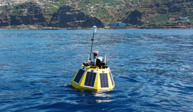
Hereon autonomous profiling buoy during operation at the coast of Calheta, Madeira in July to August of 2022. Photo: Thomas Kock/ Hereon
Over a 3-year period, MEDSEAPLAN will focus on enhancing data and scenarios to support a sustainable Mediterranean Blue Economy. The project aims to develop scientifically based tools that improve Marine Spatial Planning (MSP) through an Eco-System Based Approach (EBA). MSP in the Mediterranean is still in its early stage, with one of the main challenges being limited data availability.
In MEDSEAPLAN, Hereons main task is the design and demonstration of a new low-cost profiling buoy for collecting oceanographic and meteorological in-situ data. The buoy must be a highly robust, self-sustaining system, capable of withstanding harsh conditions over extended periods of time. Hereon leverages its design expertise and experience with a demonstrator buoy developed before MEDSEAPLAN to tackle these challenges. This effort is a Hereon internal collaboration with the department of Physical-Biological Interaction and Radarhydrograpy.
This project is funded by the European Maritime, Fisheries and Aquaculture Fund under the EMFAF-2023-PIA-FLAGSHIP Call- Agreement No.: 101124818.
more information
OLAMUR - Offshore Low-Trophic Aquaculture in Multi-Use Scenario Realization

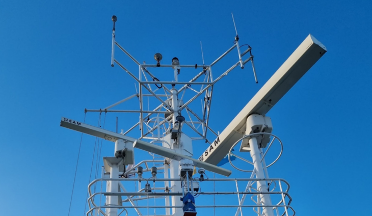
Hereons Marine Radar aboard RV Heincke during a campaign in the North Sea. Photo: Jochen Horstmann/ Hereon
The OLAMUR project aims to expand low-trophic aquaculture (LTA) by integrating it with multi-use (MU) marine spaces, such as wind farms and trout farms, to increase seafood production sustainably. Three pilot sites will be established: one in the North Sea near Helgoland, one at Kriegers Flak in the Baltic Sea, and one near the Port of Veere in Estonia. These sites will grow seaweed and blue mussels, demonstrating innovative MU-LTA solutions.
Data collected from these pilots will be used to develop the "OLAMUR digital MULTA farm service" for monitoring, simulating, and scaling MU-LTA operations. A science-policy-industry-community interface will ensure knowledge-sharing, while governance frameworks and a data-based service system will support policymakers in advancing carbon-neutral, sustainable marine space use. Through this holistic approach, OLAMUR aims to make significant contributions to sustainable, multi-functional European marine spaces.

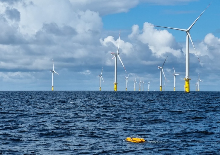
Hereon’s Autonomous Surface Vehicle gathering current measurements within the Meerwind Süd wind park, located in the German Bight of the southern North Sea. Photo: Jochen Horstmann/ Hereon
As part of OLAMUR, Hereons Radar Hydrography focuses on measuring ocean waves and currents using traditional instruments like wave buoys and Acoustic Doppler Current Profilers (ADCP), alongside innovative tools such as autonomous surface vehicles equipped with ADCP and CopterCurrents, a video drone-based system to measure surface current fields. Additionally, geochemical data will be collected within the aquaculture area using a FerryBox installed on one of the Crew Transfer Vessels (CTVs) operating within the wind park Meerwind Süd.
more information
